
Yellowstone National Park Lakes Page
In Yellowstone National Park, Yellowstone Lake is a natural lake and is the largest high altitude mountain lake in the United States at 7,733 feet above sea level. The lake harbors six fish species: cutthroat trout, longnose dace, redside shiners, lake chub, long nose suckers, and lake trout. The former two are native; the latter four were introduced in the mid-1900s.
The original lake was 200 feet higher than the present-day lake, extending northward across Hayden Valley to the base of Mount Washburn. It is thought that Yellowstone Lake originally drained south into the Pacific Ocean via the Snake River. The lake currently drains north from its only outlet, the Yellowstone River, at Fishing Bridge. The elevation of the lake's north end does not drop substantially until LeHardy Rapids. Therefore, this spot is considered the actual northern boundary of Yellowstone Lake.
In the last decade, geological research has determined that the two volcanic vents, now known as "resurgent domes", are rising again. From year to year, they either rise or fall, with an average net uplift of about one inch per year. During the period between 1923 and 1985, the Sour Creek Dome was rising. In the years since 1986, it has either declined or remained the same. The resurgence of the Sour Creek dome, just north of Fishing Bridge is causing Yellowstone Lake to "tilt" southward. Larger sandy beaches can now be found on the north shore of the lake, and flooded areas can be found in the southern arms.
Yellowstone Lake is frozen nearly half the year. It freezes in late December or early January and thaws in late May or early June. The Yellowstone River, which enters at the southern end of the lake into the Southeast Arm, dominates the inflow of water and sediment (Shanks and others, 2005).
Recent research by Dr. Val Klump of the Center for Great Lakes Research and the University of Wisconsin has revolutionized the way we look at Yellowstone Lake. Figuratively, if one could pour all the water out of Yellowstone Lake, what would be found on the bottom is similar to what is found on land in Yellowstone; geysers, hot springs, and deep canyons. With a small submersible robot submarine, the researchers (pdf document) found a canyon just east of Stevenson Island which was 390 feet deep. Prior to this finding, the deepest spot in the lake was thought to be 320 feet at West Thumb. Underwater geysers, hot springs, and fumaroles were found at West Thumb and Mary and Sedge bays. The hottest spot in the lake was found at Mary Bay where the temperature was recorded at 252° F (122° C). Hollow pipes, or chimneys of silica, several feet in height, were found rising up from the lake bottom at Mary Bay. It is thought that these are the old plumbing systems of now dormant geysers. Rock spires up to 20-feet tall were found underwater near Bridge Bay. Samples of this rock are being analyzed, though it is believed that these features are probably related to underwater thermal activity.
| Yellowstone Lake Lakebed Geology ~ USGS Map |
|---|
 |
This group of researchers also found that the conditions in Yellowstone Lake are similar to those that occur near the famous hydrothermal vents on the Pacific Ocean's mid-ocean ridge. Nutrient and mineral-rich submarine fountains support incredible plant and animal communities, including bacterial mats, sponges, and earthworms.
There is also an ongoing scientific study on Yellowstone Lake’s microbial biodiversity. This groundbreaking research will be aimed at documenting environmental relationships between many identified – and many previously unidentified – microbial species including those living in the depths of Yellowstone Lake.
| Yellowstone Lake Facts and Figures | |
|---|---|
| Facts | Figures |
| Location | 44°27'48.13" N / 110°21'19.29" W |
| Elevation in Feet | 7733 / 2,357 m |
| Miles East to West | 14 / 23 km |
| Miles North to South | 20 / 32 km |
| Miles of Shoreline | 110 / 177 km |
| Square Miles Surface Area | 136 / 35,400 hectares |
| Average Depth | 140 feet / 43 m |
| Maximum Depth | 400 feet / 122 m |
| Discharge (Yellowstone River) | 375 to 4,600 cubic feet per second |
| Average Water Temperture | 41° F / 5 C |
| Estimated Capacity | 12,095,264 acre-feet of water |
| Outflow | 1,100,000 acre-feet |
| Waters Replaced | About every eight to ten years |
| Annual water level fluctuation | Less than six feet / 1.8 m |
| Tributaries | 140+ |
| Yellowstone National Park Lakes ~ NPS Image |
|---|
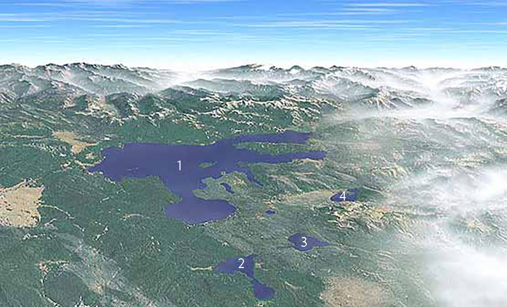 |
| 1 - Yellowstone Lake / 2 - Shoshone Lake / 3 - Lewis Lake / 4 - Heart Lake |
| Yellowstone National Park Other Major Lakes | |||
|---|---|---|---|
| Lake | Location | Elevation in Feet | Fishable |
| Heart | 44°15'54.55" N / 110°29'18.05" W | 7459 | Yes |
| Lewis | 44°18'09.87" N / 110°37'43.73" W | 7786 | Yes |
| Shoshone | 44°22'42.05" N / 110°41'40.92" W | 7795 | Yes |
Lying in the Snake River watershed west of Lewis Lake and south of Yellowstone Lake, Heart Lake was named sometime before 1871 for Hart Hunney, an early hunter. The name does not refer to the heart-like shape of the lake. During the 1890s, historian Hiram Chittenden learned from Richard "Beaver Dick" Leigh, one of Hunney's cronies, about the naming of the lake. Evidently, Capt. John W. Barlow (see Barlow Peak), who explored Yellowstone in 1871, made the incorrect connection between the lake's name and its shape. Chittenden wrote to Barlow, who could recall nothing about the naming, but Leigh "was so positive and gave so much detail" that Chittenden concluded that he was right. Chittenden petitioned Arnold Hague of the USGS to change the spelling back to "Hart Lake," but Hague refused, convinced the shape of the lake determined the name.
As for Hart Hunney, Leigh said that Hunney operated in the vicinity of Heart Lake between 1840 and 1850 and died in a fight with Crow Indians in 1852. Chittenden thought it was possible that Hunney was one of Capt. Benjamin Bonneville's men.
Shoshone Lake
Shoshone Lake, the park's second largest lake, is located at the head of the Lewis River southwest of West Thumb. It is possible that fur trapper Jim Bridger visited this lake in 1833, and fellow trapper Osborne Russell certainly reached the lake in 1839. According to James Gemmell, he and Bridger visited the lake in 1846 (in Wheeler, "The Late James Gemmell," pp. 131-136). Gemmell referred to it then as "Snake Lake," a name apparently used by the hunters.
Fr. Pierre-Jean DeSmet's 1851 map showed a "DeSmet's L." in the approximate position of present-day Shoshone Lake. In 1863, prospector Walter DeLacy visited the lake and named it "DeLacy's Lake." The lake was also called "Madison Lake" because it was erroneously thought to be the head of the Madison River. Cornelius Hedges of the 1870 Washburn Expedition named the lake after the party's leader, Gen. H.D. Washburn. By 1872, Shoshone Lake had already borne four or five names when Frank Bradley of the second Hayden Survey added a sixth. Bradley wrote: "Upon crossing the divide to the larger lake, we found it to belong to the Snake River drainage, and therefore called it Shoshone Lake, adopting the Indian name of the Snake [River]" (American Journal of Science and Arts, September 1873, p. 201). Bradley's name thus returned in spirit to Gemmell's and the fur trappers' name "Snake Lake."
Park Superintendent P.W. Norris thought that the name Shoshone Lake was "a fitting record of the name of the Indians who frequented it" (Fifth Annual Report, p. 44). The Shoshones lived mainly to the west and south of present-day Yellowstone National Park, but there is evidence that they occasionally entered the area and may have visited the lake each summer. Their arrowheads and other artifacts have been found in various places around the park.
The meaning of "Shoshone" has long been debated. Some authorities believe that the word represented an uncomplimentary Sioux expression given to the tribe by their Crow neighbors. David Shaul, a University of Arizona linguist, believes that the word literally translates as "those who camp together in wickiups" or "grass house people."
Shoshone Lake is 205 feet at its maximum depth, has an area of 8,050 acres, and contains lake trout, brown trout, and Utah chubs. Originally, Shoshone Lake was barren of fish owing to waterfalls on the Lewis River. The two types of trout were planted beginning in 1890, and the Utah chub was apparently introduced by bait fishermen. This large lake is the source of the Lewis River, which flows to the Pacific Ocean via the Snake River system. The U.S. Fish and Wildlife Service believes that Shoshone Lake may be the largest lake in the lower 48 states that cannot be reached by road. No motorboats are allowed on the lake.
| Yellowstone National Park Smaller Lakes | |||
|---|---|---|---|
| Lake | Location | Elevation in Feet | Fishable |
| Africa / Beatty | 44°56'59.03" N / 110°42'48.67" W | 6818 | No |
| Alder | 44°20'12.30" N / 110°18'43.42" W | 7746 | Yes |
| Allison | 44°36'44.77" N / 110°26'09.50" W | 7855 | No |
| Aster | 44°18'03.87" N / 110°33'31.04" W | 8171 | No |
| Basin Creek | 44°12'28.99" N / 110°31'31.99" W | 7394 | Yes |
| Beach | 44°32'29.99" N / 110°34'14.04" W | 8151 | No |
| Beaver | 44°49'22.62" N / 110°43'45.15" W | 7381 | Yes |
| Beaver Ponds | 44°58'47.26" N / 110°43'45.04" W | 7405 | No |
| Beula | 44°09'36.01" N / 110°45'56.92" W | 7411 | Yes |
| Big Bear | 44°33'28.40" N / 111°01'01.02" W | 8004 | No |
| Blacktail Ponds | 44°57'20.31" N / 110°36'07.03" W | 6602 | Yes |
| Buck | 44°54'15.07" N / 110°07'33.01" W | 6957 | Yes |
| Buffalo | 44°19'44.63" N / 110°04'26.64" W | 7691 | No |
| Cache | 44°59'12.76" N / 110°48'19.09" W | 8044 | No |
| Cascade | 44°45'05.62" N / 110°31'22.07" W | 7995 | Yes |
| Chickadee | 44°28'04.58" N / 110°36'57.60" W | 8323 | No |
| Clear | 44°42'48.86" N / 110°28'47.27" W | 7819 | No |
| Crag | 45°03'28.45" N / 110°58'43.30" W | 8784 | No |
| Crescent | 45°03'37.50" N / 111°00'08.97" W | 8624 | No |
| Crevice | 45°00'02.21" N / 110°34'41.81" W | 5560 | No |
| Cygnet Lakes | 44°39'50.17" N / 110°36'54.18" W | 8296 | No |
| De Lacy Lakes | 44°28'42.18" N / 110°42'49.57" W | 8520 | No |
| Delusion | 44°23'56.19" N / 110°27'24.97" W | 7823 | No |
| Dewdrop | 44°40'19.80" N / 110°21'51.88" W | 8079 | No |
| Divide | 44°54'43.03" N / 111°03'05.32" W | 7230 | No |
| Dryad | 44°32'44.62" N / 110°30'42.47" W | 8306 | No |
| Duck | 44°25'14.60" N / 110°34'49.66" W | 7795 | No |
| Eleanor | 44°28'11.25" N / 110°08'25.27" W | 2472 | Yes |
| Fawn | 44°57'12.08" N / 110°47'57.67" W | 7793 | Yes |
| Fern | 44°40'41.38" N / 110°16'33.51" W | 8252 | Yes |
| Floating Island | 44°56'31.26" N / 110°27'01.12" W | 6597 | No |
| Forest | 44°09'48.17" N / 110°38'18.41" W | 7426 | No |
| Frost | 44°36'12.75" N / 110°01'09.53" W | 8840 | No |
| Gallatin | 44°51'20.37" N / 110°52'57.70" W | 8825 | No |
| Goose | 44°32'32.27" N / 110°50'34.94" W | 7224 | Yes |
| Gray Lakes | 44°42'57.62" N / 110°41'52.92" W | 7813 | No |
| Grebe | 44°45'05.71" N / 110°33'31.34" W | 8028 | Yes |
| Grizzly | 44°48'29.81" N / 110°46'30.80" W | 7512 | Yes |
| Harlequin | 44°38'39.08" N / 110°53'28.16" W | 6894 | No |
| Hering | 44°08'44.14" N / 110°45'44.16" W | 7411 | Yes |
| High | 45°03'26.77" N / 110°57'15.31" W | 8674 | Yes |
| Hot | 44°32'38.57" N / 110°47'20.69" W | 7369 | No |
| Ice | 44°43'15.41" N / 110°37'38.78" W | 7894 | No |
| Indian Pond | 44°33'28.56" N / 110°19'28.71" W | 7762 | Yes |
| Isa | 44°26'27.00" N / 110°43'09.01" W | 8280 | No |
| Joffe | 44°56'51.18" N / 110°42'04.10" W | 6506 | Yes |
| Lacombe | 44°54'46.34" N / 110°20'55.31" W | 6197 | No |
| Lake of the Woods | 44°48'01.84" N / 110°42'52.07" W | 7754 | No |
| Lake Wyodaho | 44°13'57.40" N / 110°59'09.82" W | 6788 | No |
| Lemonade | 44°46'41.79" N / 110°44'33.75" W | 7576 | No |
| Lily Pad | 44°09'57.71" N / 111°00'39.66" W | 6414 | No |
| Little Summit | 44°24'58.77" N / 110°57'09.70" W | 8622 | No |
| Lost | 44°54'34.05" N / 110°25'47.49" W | 6723 | No |
| Madison | 44°20'55.13" N / 110°51'54.92" W | 8215 | No |
| Mallard | 44°28'40.37" N / 110°46'33.70" W | 8054 | No |
| Mariposa | 44°08'49.30" N / 110°12'10.85" W | 9401 | Yes |
| Mary | 44°36'12.66" N / 110°38'18.23" W | 8240 | No |
| McBride | 44°57'50.24" N / 110°15'08.90" W | 6590 | Yes |
| Mirror | 44°44'06.76" N / 110°09'48.36" W | 8959 | No |
| Nuthatch | 44°27'32.23" N / 110°37'03.34" W | 8378 | No |
| Nymph | 44°45'07.16" N / 110°43'35.92" W | 7504 | No |
| Obsidian | 44°50'11.24" N / 110°42'59.71" W | 7735 | No |
| Outlet | 44°16'17.43" N / 110°23'33.92" W | 7796 | Yes |
| Phantom | 44°57'20.06" N / 110°31'37.21" W | 6777 | No |
| Plateau | 44°27'40.05" N / 110°59'57.47" W | 8823 | No |
| 44°23'44.64" N / 110°44'29.73" W | 8160 | Yes | |
| Rainbow | 45°01'19.68" N / 110°44'26.63" W | 5882 | No |
| Ranger | 44°13'13.73" N / 110°57'58.22" W | 6967 | Yes |
| Ribbon | 44°43'27.54" N / 110°26'52.75" W | 7819 | Yes |
| Riddle | 44°21'23.63" N / 110°32'57.77" W | 7921 | Yes |
| Robinson | 44°10'31.57" N / 111°03'29.15" W | 6502 | No |
| Scaup | 44°25'49.84" N / 110°46'01.86" W | 7916 | No |
| Sedge | 45°03'48.69" N / 110°59'08.97" W | 8864 | No |
| Shelf | 45°05'31.67" N / 111°00'46.33" W | 9153 | No |
| Sheridan | 44°14'37.41" N / 110°30'19.74" W | 7400 | Yes |
| Shrimp | 44°54'19.96" N / 110°07'51.58" W | 7083 | No |
| Slide | 45°00'14.15" N / 110°41'56.90" W | 5711 | Yes |
| South Boundary | 44°08'00.85" N / 110°45'21.44" W | 7375 | No |
| Sportsman | 45°03'23.43" N / 110°56'18.10" W | 8780 | Yes |
| Squaw | 44°33'28.56" N / 110°19'28.71" W | 7762 | No |
| Summit | 44°24'53.28" N / 110°56'25.12" W | 8550 | No |
| Swan | 44°55'10.26" N / 110°44'09.26" W | 7275 | No |
| Sylvan | 44°28'46.19" N / 110°09'39.11" W | 8417 | Yes |
| Tanager | 44°08'06.22" N / 110°41'05.75" W | 6976 | Yes |
| Teal | 44°27'37.24" N / 110°45'12.20" W | 8434 | No |
| Tern | 44°39'54.28" N / 110°16'02.15" W | 8224 | No |
| Trail | 44°16'41.36" N / 110°10'26.91" W | 7759 | Yes |
| Trilobite | 44°49'45.50" N / 110°50'07.01" W | 8355 | Yes |
| Trout | 44°54'02.06" N / 110°07'47.15" W | 6961 | Yes |
| Turbid | 44°32'59.34" N / 110°15'36.69" W | 7840 | No |
| Twin Lakes | 44°46'16.00" N / 110°44'04.80" W | 7537 | No |
| Wapiti | 44°42'10.86" N / 110°25'48.19" W | 8155 | No |
| White | 44°39'20.73" N / 110°16'36.88" W | 8235 | Yes |
| Winegar | 44°07'42.79" N / 110°59'36.18" W | 6315 | Yes |
| Wolf | 44°44'48.91" N / 110°35'07.91" W | 8004 | Yes |
| Wrangler | 44°40'59.74" N / 110°26'08.09" W | 7856 | No |
There are 140+ smaller lakes and ponds in Yellowstone National Park
Information provided by the National Park Service and the U.S. Geologic Survey


| Yellowstone National Park WebCams | |||
|---|---|---|---|
| All WebCams | East Entrance | Mammoth | Mount Washburn |
| North Entrance | Old Faithful Live | West Entrance | YVO WebCam |
| All WebCams |
|---|
| All U.S. National Parks, National Monuments, National Recreational Areas, and National Seashore WebCams |
| Entrance Cities and Gateway Towns | |||
|---|---|---|---|
| Gardiner, Montana | Silver Gate, Montana | West Yellowstone, Montana | Cooke City, Montana |
| Livingston, Montana | Cody, Wyoming | Jackson Hole, Wyoming | Yellowstone National Park |

| Links | |
|---|---|
| The Great Outdoors Net | Great Outdoor Recreational Places |
| Gardiner, Montana | West Yellowstone, Montana |
 |  |